Trimble (Nasdaq: TRMB) announced the launch of the Trimble APX RTX portfolio, a new line of direct georeferencing solutions for mapping sensors on uncrewed aerial vehicles (UAVs). This release allows original equipment manufacturers and drone payload integrators to provide their customers with high accuracy and reliable map products in various environments.
The integration of Trimble CenterPoint RTX enables real-time and post-mission direct georeferencing of camera, LiDAR and hyperspectral mapping sensors on UAVs, achieving centimeter-level accuracy without the need for base stations. This was unveiled at INTERGEO 2024, a leading conference for geodesy, geoinformation and land management.
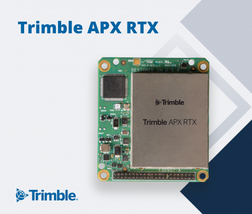
The Trimble APX RTX features compact, survey-grade GNSS inertial hardware for real-time positioning and precise measurements of roll, pitch and heading. It offers four variants suited for different flying heights and beyond visual line of sight operations, designed for greater orientation accuracy.
“Trimble pioneered the use of direct georeferencing more than 25 years ago and innovation in this space remains a focus today,” said Joe Hutton, director of inertial technology and airborne products at Westminster-based Trimble.
Trimble Field Systems develops hardware, software and services that connect site operations to the office across various industries, including civil construction, surveying, mapping and more.